


 The Kauai Travel Map
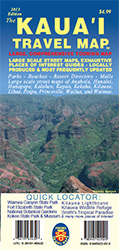
A large, comprehensive touring map provides you with an overview of the island of Kauai. As with our other products, the touring map includes detailed point of interest information. The Kauai Travel Map also includes detailed street maps of all major areas including Anahola, Hanalei, Hanapepe, Kalaheo, Kapaa, Kekaha, Kilauea, Lihue, Poipu, Princeville, Wailua, and Waimea.
4.125 x 9 " folded, 33" x 23.5" open, full color on both sides. - $5.95 + S/H
We are pleased to offer this title for sale via our distribution partner, Booklines of Hawaii. Please visit their site to order your copy.


